
It is said that the accuracy of location information services, which are used for automatic driving of car navigation systems and drones, and recently for improving the accuracy of 3D surveying at civil engineering sites, will continue to increase in the future. When it comes to location information, the first thing that comes to mind is GPS, but recently, services using “RTK”, a more accurate measurement method, have appeared and are attracting attention.
This time, after confirming the characteristics of RTK and the differences between RTK and conventional positioning technologies such as GPS, let’s consider the possibilities that RTK expands.
Table of Contents
ToggleTable of contents
- What is a positioning system using satellites?
- Difference between RTK and GPS
- Possibilities Expanded by Using RTK
- Summary
What is a positioning system using satellites?
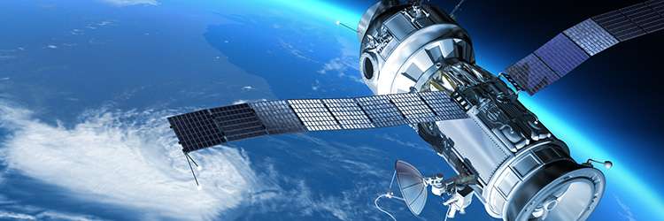
Using car navigation systems and map apps on smartphones, you can find out where you are on the earth, and these services use satellite positioning systems. Receivers such as car navigation systems and smartphones receive signals transmitted from satellites and measure the distance between the receiver and the satellite based on the signals. Once the distances between the four satellites and the receiver can be measured, the point where they intersect is calculated and the current position is known.
Satellite positioning systems include GPS, QZSS (Quasi-Zenith Satellite), GLONASS, Galileo, etc. These are collectively called “GNSS (Global Positioning Satellite System)”.
GPS is probably the most familiar of the GNSS. GPS is a satellite positioning system originally developed by the US Department of Defense for military purposes, but it began to spread to the private sector in the 1990s and is now widely used in car navigation systems and smartphone applications.
QZSS (Quasi-Zenith Satellite), which consists mainly of satellites in quasi-zenith orbit, is a unique positioning satellite of Japan. Commonly known as “Michibiki”, it is sometimes called the Japanese version of GPS. By supplementing GPS with MICHIBIKI, it is expected that more stable location information can be obtained.
Difference between RTK and GPS
There are several ways to determine position using a satellite positioning system. Since the accuracy differs depending on the type, the suitable fields of application also differ. Let’s take a look at the features and differences between single positioning, which is generally widely used, and RTK, which is attracting attention as a new measurement method.
What is GPS (single positioning)?
The measurement method used in location-based services, commonly known as GPS, is called stand-alone positioning. A basic, widely used measurement method in which a single receiver receives signals from four or more GPS or GNSS satellites and calculates the position by measuring the distance from each satellite.
In addition to being used by airplanes and ships to determine their position, GPS-based independent positioning is used for security services such as navigation systems installed in automobiles, walking navigation for smartphone map apps, and monitoring functions for mobile phones for children. It is used for various purposes such as SNS that can be published and shared.
However, measurement with a single receiver has the disadvantage of causing an error of several meters in position information, making it unsuitable for fields that require more precise position information.
What is RTK?
RTK is an abbreviation of “Real Time Kinematic” and is one of the measurement methods called “relative positioning”. A technology that receives signals from four or more satellites with two receivers, a fixed station, and a mobile station. Exchanging information between the two receivers and correcting for discrepancies, it is more accurate than single positioning. You can get location information.
The greatest feature of RTK is that although there are some errors, the range can be suppressed to within a few centimeters. It is expected that the application will expand mainly in fields that require more accurate position information, such as agricultural machinery, construction machinery, and automatic navigation of drones.
For example, when automatically navigating a drone along a set route, it is common to use GPS (unidirectional positioning) at present, but an error may occur and the drone may deviate from the route and fly in a different direction. There is also a risk of chilling and colliding with neighboring buildings. With the introduction of RTK, more accurate, stable, and low-risk flight becomes possible.
Possibilities Expanded by Using RTK
RTK, which can measure position information with high accuracy, will expand the use of position information using positioning satellite systems even in fields where GPS has not spread due to error. It may also lead to smart industries and the emergence of new services.
Recently, it has been attracting particular attention for its use in the civil engineering field of construction. The Ministry of Land, Infrastructure, Transport, and Tourism also recommends
a method of realizing 3D surveying without an expensive laser scanner by combining the LiDAR function installed in smartphones and tablets with a GNSS receiver that performs RTK positioning.
In other fields, such as agriculture, the use of RTK will enable the automatic operation of agricultural machinery such as tractors, as well as pesticide spraying by drones. It is also being considered for automation of monitoring work in traffic infrastructures such as roads and bridges, sensors for infrastructure monitoring, delivery work using drones in the transportation industry, and wearable terminals for training in the professional sports industry.
High-precision satellite positioning services using RTK are currently provided by multiple companies in Japan. One of them is “ichimill,” which SoftBank started offering in November 2019. It is attracting attention as an epoch-making service that enables highly accurate positioning in a wide range of industries.
What is the high-precision positioning service “ichimill”?
“ichimill” is a service that performs highly accurate positioning with an error of several centimeters by receiving signals from GNSS such as “Michibiki” and performing RTK positioning. SoftBank has set up its reference points in more than 3,300 locations nationwide to provide this service. We use SoftBank’s mobile network for communication.
Since there are high-density reference points in wide areas all over the country, users do not need to set up reference points, and the service can be used easily and inexpensively. In addition, even when a receiver such as a drone moves long enough to cross the reference point, it is possible to perform highly accurate and stable positioning while automatically switching the reference point.
Originally, an expensive GNSS receiver is required to use the RTK service, but SoftBank has developed a low-cost dedicated GNSS receiver. We are also developing a cloud-based service that enables RTK positioning without a GNSS receiver. If cloud RTK is realized, it will be easier to use RTK positioning for small infrastructure monitoring sensors and wearable terminals.
“ichimill” is expected to be used in fields such as automatic driving and assisting of agricultural machinery, construction site management by drones, and automatic driving of buses, and SoftBank is promoting demonstration projects with partner companies in each field.
With the start of the provision of “ichimill”, which is cheaper and easier to use than conventional RTK services, it is expected that RTK will become more familiar to many companies in the future and will be put into practical use.
Summary: Expectations for unmanned operation and improved operational efficiency through more advanced positioning
RTK enables high-precision positioning with an error of only a few centimeters. As it is a state-of-the-art technology, the cost to introduce it was a bottleneck, but with the advent of new services such as “ichimill”, the hurdles to introducing RTK are gradually decreasing. By using high-precision RTK positioning to realize automated driving and unmanned monitoring, work efficiency is expected to be reduced and costs are expected to be reduced. It is expected to be one of the technologies responsible for the automation of equipment.
Positioning technology using artificial satellites, represented by GPS and RTK, is evolving rapidly. To continue creating value in the rapidly changing digital age, it is important to flexibly incorporate new technologies. Why don’t you think again about how to use the latest technologies such as positioning and IoT in your company’s business? Borrowing the help of a specialized company like Softbank in the process of promoting innovation is also a useful option.